
The main characteristics are:
- Coordinates Lat/Lon, UTM and TM (user-defined Gauss-KrЁ№ger projection)
- 270 Map Datums predefined
- Map Datum denfined by the user
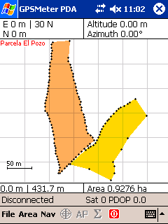
- Precise Calculation of the area using projection UTM and TM
- Calculation of distances in 2D
- Precise reading of the position of the GPS using averages
- Introduction of waypoints in Lat/Lon, UTM and TM
- Conversion between coordinates and zones
- Navigation to the waypoints
- Offsets in measured positions
- Units of measurement: Metric system or Imperial
- Export data in ESRI Shapefile
- Export data in ASCII
- Export data in DXF
- Export data Google Earth KML
- Scales and Zoom
- VGA compatible
- Languages: English, German, French, Spanish and Portuguese
Ссылка на форуме GPS